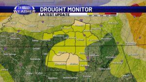
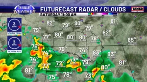
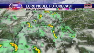
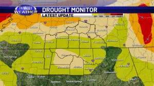
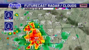
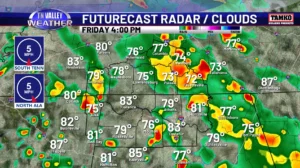
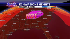
skip to content

Low impact risk of a few storms with gusty winds or small hail today. Severe storms still possible Friday night although some question marks. High-impact severe weather threat Saturday!

Radar is a little active on this Thursday morning with scattered showers and thunderstorms spinning around a weak upper-level disturbance crossing the area. These storms aren’t too much in the way of trouble, but there is a low-end Level 1 of 5 risk of severe storms for the late morning to early afternoon that clips

Low impact risk of a few storms with gusty winds or small hail today. Severe storms still possible Friday night although some question marks. High-impact severe weather threat Saturday! Read More »

Up and down temps next few days, weekend rain chances, and then warmer weather next week.

Sunshine returns to the Tennessee Valley today, but we are still firmly in the clutches of chilly air. It will continue to be breezy today with northwest winds of 7 to 13 mph that may gust as high as 20 mph at times. That might make the daytime highs of the upper 40s to lower

Up and down temps next few days, weekend rain chances, and then warmer weather next week. Read More »